After a slow start to a hurricane season that was hyped to be anything but slow, today marks the first full day since the development of Tropical Depression #6 on August 21 (which would later become Hurricane Danielle) that we've gone without a named storm in the Atlantic basin. Although we almost did it between September 5–6 when Hurricane Earl dissipated in the north Atlantic, we were surprised when Tropical Depression #10 (which would later become Tropical Storm Hermine) quickly spun up in the southwestern Gulf of Mexico before making landfall in extreme northeastern Mexico. This marks a total of 36 days having a named storm, the longest such period since the 2002 Atlantic hurricane season, which had remained completely active for 45 days from August 29 through October 12.
We are well into an above-average Atlantic hurricane season with 13 named storms and two unnamed tropical depressions, and there are only eight more names available for use before we'd need to break into Greek alphabet, which has only been done once in history – during the epic 2005 Atlantic hurricane season. With that said, today's break in activity leaves us on edge after yesterday's degeneration of both Lisa and Matthew, wondering where Nicole is... and will Otto follow?
According to the National Hurricane Center (NHC) there is an increasingly likely chance we'll see our next named storm this week as an area of convection continues to flare up in the northwest Caribbean Sea which in the short-term seems to have its eyes on the southeastern Gulf coast. Meanwhile, a very small area of convection flared overnight in the central Atlantic, but development of this system is not likely in the near-term.
There is not yet an official invest on the system in the Caribbean but by day's end I would expect to see 96L pop up! At that time the computer models should have a better handle on what the system might do – where it might go, how fast it might develop and how strong it could become. To that extent I encourage all interests in the northwest Caribbean and Gulf of Mexico to monitor possible development in this region as the break in tropical activity seems to be short-lived!
[UPDATE #1: As of 3:30 p.m. ET 09-27-10, we officially have 96L invest.] [UPDATE#2: As of 11:00 a.m. ET 09-28-10, we officially have Tropical Depression #16.] I'll leave you with 2010 Atlantic hurricane season scorecard, courtesy of The Weather Channel:
Now that you've all read my Hurricane Igor chase recap, hear it through Greg Nordstrom as he reviews his experience in Bermuda last week on his blog, EYE OF THE STORM! Greg posted his blog yesterday along with some pretty amazing videos and I definitely encourage you to check them out at hurricanechaser.net!
Great job, Greg! Looking forward to chasing with you again in the very near future!
Greg and Devin provide an in-depth recap of their experience riding out and chasing Hurricane Igor in Bermuda!
Earlier this evening Greg Nordstrom and I were featured on The Barometer Bob Show as we recapped our Hurricane Igor chase in Bermuda! Scroll to minute 20:10 to hear the interview...
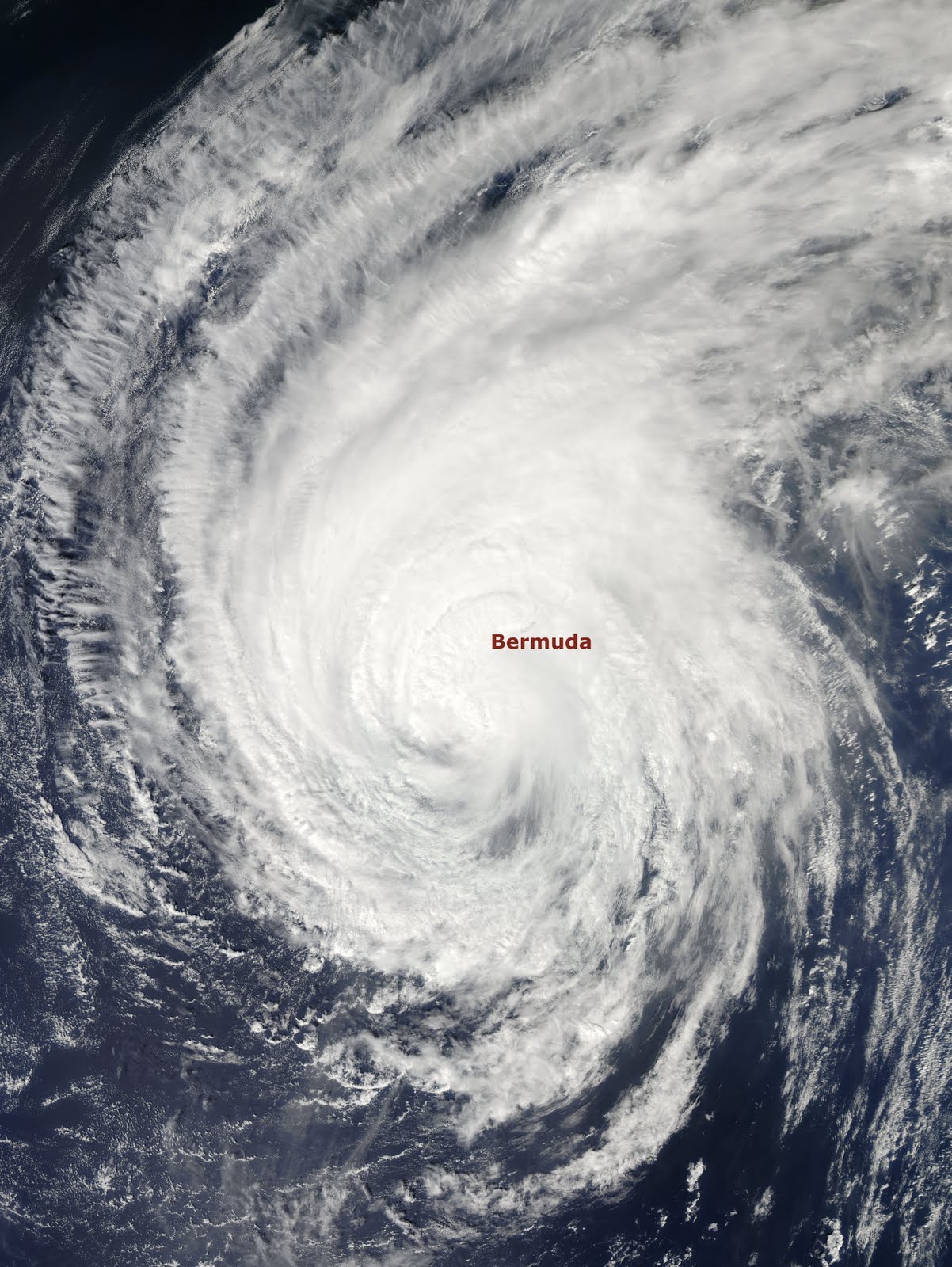
Well, after nearly a week of chasing the strongest hurricane thus far in the 2010 Atlantic season, I am finally back home in New York! Despite the storm’s weakened state upon its approach to Bermuda, chasing Hurricane Igor on that tiny north-Atlantic island was undoubtedly one of my greatest moments as a weather enthusiast!
The chase began on Thursday, September 16, as Greg Nordstrom and I were to depart from New York’s JFK airport but were delayed until Friday morning, September 17 due to severe weather in the area. We spent the night trying to sleep on the cold terminal floor, which sounds absolutely awful, but we did manage to have a bit of fun. We made friends with a girl by the name of Vanessa and the three of us huddled together, enjoyed some cocktails at the airport bar and tried to make the most of the situation.
On Friday morning the flight departed and arrived as smooth as could be. Upon arrival in Bermuda a local journalist by the name of Patricia contacted us and she was doing a story on Hurricane Igor and the storm chasers that were invading her island nation. We spent a few days before Igor’s landfall traversing the island with Patricia and we are so grateful for that opportunity, for without her guidance we would never have seen the things we did! From viewing roaring, crashing waves on Bermuda’s south shore to witnessing locals boarding up their homes in the lovely neighborhoods that line Bermuda’s coast – it was truly a unique experience.
On Friday afternoon Hurricane Igor began to somewhat deteriorate in organization as it officially made that northward turn and began its approach towards Bermuda. However, well in advance of what was a category 2 hurricane at the time (on its way to a category 1 from a strong category 4), Igor was responsible for a significant coastal battering. Surge was already rolling in along Bermuda’s south shore, especially into tributaries and inlets opening up to the fierce Atlantic. We were informed that areas we were looking at that appeared as a lake or river, were actually land – and this was at least 30 hours prior to Igor’s near direct hit.
Since Hurricane Igor was so massive in size, having been the third largest Atlantic hurricane ever recorded, conditions started going downhill on Saturday evening. By the time we went to sleep we were easily experiencing tropical depression conditions and by the middle of the night a weak tropical storm was in full effect.
Sunday was the day! By sunrise the winds were howling and the rain was pouring. The surf was kicking up more than it had in day’s prior and Bermuda was well entrenched in strong tropical storm conditions. Throughout the day the winds steadily increased and as evening dawned upon us we were officially experiencing Hurricane Igor, and would for the several hours to come.
During the height of the storm we took some risks but safety was on the top of our minds. While it might appear that we were too close for comfort, we made sound decisions and never felt that our life was in danger.
Although category 1 Hurricane Igor never made a direct hit to Bermuda, for the duration of the storm we were in the northeast quadrant – the strongest part of the storm, so we did feel the brunt of the impact. Many people said (locals and storm chasers alike) that Igor was the “best” and/or “strongest” category 1 hurricane they had ever experienced. I have not been in many but from what I witnessed in chasing this massive storm, I concur!
Throughout the storm as conditions and connectivity allowed, I kept everyone up to date on The Northeast QuadrantFacebook page. I know they really enjoyed seeing all the footage first-hand and I am so grateful to have been able to share the storm with them. I also submitted some footage to The Weather Channel which was aired on television and is still available online. I also conducted an interview with The Weather Channel via Skype, which aired live on Sunday morning just before the onset of Igor’s hurricane force winds.
Below you will find a movie I put together which combines the best footage from over 100 clips I filmed before and during the storm, as well as a slideshow of photos. Despite the dramatic feel these medium convey, as you can imagine it in no way showcases actually being in the storm!
Thank you so much for allowing me to share this experience with all of you – it is, after all, not only chasing Igor, but also me chasing my dream! Return to home
An online video talk show offering a blood pumping new look at weather from a personal perspective!
The Northeast Quadrant Radar
About The Northeast Quadrant
The Northeast Quadrant is a highly informative blog and global interactive social community for the weather obsessed, written and managed by the weather obsessed!
Near daily blog posts and news shares about ever-changing weather patterns, the evolution of dynamic storm systems, the controversy surrounding climate change; and its effects on our cities, nation and the world, The Northeast Quadrant takes you beyond the weather and brings you closer to science through its unique presentation of incredible news stories and vibrant personal experiences! With thousands of web hits directly on the blog, hundreds of Facebook fans, and Twitter followers, and an overwhelming viewer audience on YouTube, The Northeast Quadrant continues to grow!
Bookmark and subscribe to http://northeastquadrant.blogspot.com/ and enjoy! In doing so you'll join the global community from countries around the world that regularly visit The Northeast Quadrant.
What are people saying about The Northeast Quadrant?
"Congratulations to The Northeast Quadrant for making weather fun! This is not the kind of information you get from your local weatherperson." – Janette from Washington, DC
"I am in the midst of grueling Navy Weather Forecasting school. It's fun sometimes, but we don't really get into anything outside of the subject matter. I appreciate The Northeast Quadrant because it's an interesting look at weather and facts. It provides a much needed break from mundane, tedious weather lessons! Thanks Devin!" – Mack from Biloxi, Mississippi
"I really enjoy reading The Northeast Quadrant! Devin does a great job and keeps things interesting. You can see the passion he has for the tropics and that's something I always respect! I have learned as a teacher of meteorology, that you can't teach passion – you either have it, or you don't!" – Greg from Starkville, Mississippi
"Throughout all the recent Icelandic volcanic news, we at Know Your Money like to keep updated with blogs to discover their opinion of what is going on. The Northeast Quadrant offers a great deal of interest to us with regards to its intake on weather etc., and its impact on the economy... so thank you!" – Claire from United Kingdom
"I visit The Northeast Quadrant at least once a week for weather and science updates on things happening around the world. What I often find interesting is that I will read The Northeast Quadrant in the early part of the day and learn something that isn't on the news until later that night. I would be remiss if I didn't mention the fantastic pictures everyone sends in from all over!" – Staci from Union, New Jersey
"I visit The Northeast Quadrant at least 3-5 times a week. I love the pictures and funny stories, articles, quotes, etc. The blog is a good resource, it's entertaining and has valuable information. It has actually made me more interested in what is going on with the weather and why things happen." – Glen from Orem, Utah
"I find myself visiting The Northeast Quadrant more than I ever expected! I enjoy seeing Devin act so funny when he reports on various weather phenomenon. He really makes me like weather, and I particularly enjoy the photos and videos. The Northeast Quadrant has actually changed my perspective on weather and science." – Meghan from Silver Spring, Maryland
"I love The Northeast Quadrant! The information given to me is always accurate and informative. When we were listening to the news about upcoming storms this past winter, I relied on The Northeast Quadrant more than the local news. I liked watching Devin at the East River reporting and nearly getting blown away! There were always updates every few hours, and in fact I was able to prepare in advance of the storm. I also enjoy looking at and submitting personal photos pertaining to the weather!" – Robin from Edison, New Jersey
Marketing and Communications Professional; Weather Enthusiast; Recreational Storm Tracker and Reporter; and Amateur Photographer
Ever since I was a young boy I loved the weather!
There was very little that excited me more than watching The Weather Channel since its inception in 1982. Bringing weather to life was the Channel's goal, and it delivered! I remember watching the local forecast as intense lines of storms progressed towards Edison, New Jersey (where I grew up), and being called by my father to join him on the front porch as he watched the storms close in on our neighborhood. I'd run back and forth between the gusty front porch that lied beneath the darkening sky to the cool air-conditioned living room, starring at the television as I glared at the storms getting closer and closer. As the line of vibrant red's and orange's intensified, so did my interest! My obsession for weather was born, and that's where it started!
With the tools I needed at my disposal I continued to closely follow various weather phenomenon: deadly mid-western tornado outbreaks, extreme Mississippi River flooding, Hurricanes Hugo and Andrew, crippling northeastern blizzards like the '93 Superstorm, earthquakes in the Golden State, volcanoes along the Pacific Rim... you name it!
Nearly 30 years later, those who know me well would say I have not changed all that much.

 After a slow start to a hurricane season that was hyped to be anything but slow, today marks the first full day since the development of Tropical Depression #6 on August 21 (which would later become Hurricane Danielle) that we've gone without a named storm in the Atlantic basin. Although we almost did it between September 5–6 when Hurricane Earl dissipated in the north Atlantic, we were surprised when Tropical Depression #10 (which would later become Tropical Storm Hermine) quickly spun up in the southwestern Gulf of Mexico before making landfall in extreme northeastern Mexico. This marks a total of 36 days having a named storm, the longest such period since the 2002 Atlantic hurricane season, which had remained completely active for 45 days from August 29 through October 12.