Friday, May 28, 2010

NEQ Friday Review, V.4

Despite all the recent predictions for an extreme hurricane season ahead, never in history have meteorologists seen a run-up to a season as sobering as what we're looking at now. In fact, since the end of World War II ocean temperatures in the hurricane-prone waters of the Atlantic have never been warmer this early in the season than they currently are – not even prior to the epic 2005 hurricane season, which featured 28 named storms, including Katrina, Rita, Wilma, and several storms that pushed us into using the Greek alphabet.

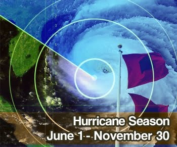
With such worrisome forecasts looming, today's NEQ Friday Review will take a look back at the 2005 hurricane season to see what we might be up against over the next 183 days spanning June 1 through November 30 (and possibly longer).
  • The 2005 hurricane season was the most active in 154 years of records being kept.
  • 2005 hurricane season held the most named storms at 28.
  • For the first time since the current naming system was introduced in 1953, all 21 names on 2005 hurricane season's list were used, forcing the National Hurricane Center to name 6 later storms after letters in the Greek alphabet.
  • The 2005 hurricane season featured more hurricanes than any other season with a grand total of 15.
  • The 2005 hurricane season featured the most Category 5 storms with a total of four, including Emily, Katrina, Rita and Wilma.
  • The 2005 hurricane season featured the earliest Category 5 storm with Emily on July 17.
  • The 2005 hurricane season featured the most retired storm names with a grand total of five, including Dennis, Katrina, Rita, Stan and Wilma.
  • Hurricane Katrina, the 11th named storm of the 2005 hurricane season, now stands as the costliest U.S. hurricane at $96 billion dollars. Hurricane's Rita and Wilma also made the top 10 list.
  • Hurricane Wilma, the 21st named storm of the 2005 hurricane season was recorded as the most intense Atlantic hurricane ever at sea.
  • The 2005 hurricane season featured Tropical Storm Vince, the only storm to ever form so far east that it actually made landfall in Spain.
  • Finally, the 2005 hurricane season featured tropical storm Zeta, which was only the second storm ever to bridge December and January.
Whew! What staggering facts! It seems that any of these would be hard to beat, and hopefully we won't do it!

Meanwhile, enjoy your Memorial Holiday Weekend and remember, hurricane season begins Tuesday, June 1!

Thursday, May 27, 2010

Comparing NOAA's Hurricane Forecast to Others

It seems I've been blogging for months about hurricane season predictions and for just as long I've been mentioning the long-awaited official forecast for the 2010 Atlantic season by NOAA's Climate Prediction Center. All the hype was built up leading up to the expected release of their forecast last Thursday, just to find out it was delayed until today.

So alas, here it is – the official big daddy prediction we've been waiting for...

NOAA is predicting 14 to 23 named storms to form in the Atlantic Ocean, Caribbean Sea and Gulf of Mexico. Of those named storms, 8 to 14 should become hurricanes, including 3 to 7 majors. As there are only 21 names dedicated to storms in any given season, if we do reach the higher end of their forecast, we could easily push into the Greek alphabet, which has only happened once before in 2005

I'm not going to spend time reasoning why they are predicting such an active season – I think I beat that dead horse already! Here are a couple links to previous blog posts that touch on the predictors forecasters look at when issuing these seasonal hurricane forecasts:

NOAA's hurricane forecasts have been accurate in 5 out of the 10 years in this decade. Their prediction was too low in 4 years, and too high in just one year: 2006. 8 of the 10 years in the decade saw above-average activity.

For reference, here are the other predictions I've already blogged about:

Good thing I grabbed hold of some extra dry erase markers and sticky hurricane symbols for my tracking chart – looks like I'm surely going need them!

Wednesday, May 26, 2010

25th Anniversary of Ozone Hole Discovery

25 years ago in May 1985, scientists from the British Antarctic Survey (BAS) officially discovered the now controversial hole in Earth's ozone layer. The feature, which has expanded and contracted since its discovery, has been responsible for large losses of ozone in Earth's atmosphere over Antarctica.

The discovery of the ozone hole alerted the world to a major environmental threat as the accumulation of chlorofluorocarbons (CFCs) used in industrial solvents were found to deplete the protective layer of ozone that surrounds the Earth.

Action by governments around the world led to the 1987 Montreal Protocol and its amendments, which ensured that production and consumption of CFCs, halons and carbon tetrachloride were phased out by 2000, and methyl chloroform by 2005. All members of the United Nations have now signed the Montreal Protocol.

In good news, the ozone layer depletion seems to be on a dramatic upswing and levels of ozone are expected to continue to reach safer levels in the coming decades.

Friday, May 21, 2010

NEQ Friday Review, V.3

I am on the train this morning riding Amtrak's Northeast Corridor from New York City to Boston, as I embark on a week of business meetings. A gorgeous morning indeed, the skies are deep blue and as we pulled away from the Big Apple just about an hour ago, the sunkissed skyline was magnificently displayed in my left window while the edgy coastline of Long Island lay to my right. Check out this photo that I snapped on my iPhone as the train was pushing away from the city.

In this week's NEQ Friday Review I am actually going to review last month. Did you know that since record-keeping began in 1880, April 2010 was the warmest April EVER recorded across the globe, and the second consecutive warmest month? It's true!

For the United States specifically, it was the 14th warmest April with five states recording their warmest: Illinois, Maine, Rhode Island, Connecticut, and New Jersey. Sixteen other states had their top 10 warmest.

Additionally, no other period from January through April has been warmer on planet Earth. This means that 2010 is on track to be the warmest year ever! Hard to believe when the year kicked-off with sub-freezing temperatures and epic blizzards, but hey... that's just here – we're talking globally now!

One other interesting fact – the decade beginning in 2000 has also been recorded as the warmest.

Global warming? Climate change? You decide...

Thursday, May 20, 2010

Government's Hurricane Forecast Delayed, Chimpanzee Issues His

Weather geeks everywhere have been waiting for today to learn the Climate Prediction Center's (CPC) official 2010 Atlantic Hurricane Season forecast... but alas, the CPC has put off until next Thursday, May 27, a press conference that will bear their predictions. The suspense is killing me!

So meanwhile the National Center for Public Policy Research is questioning the government's ability to really predict the hurricane season with accuracy. They are debating it so much that this week they put a chimpanzee to the test. Check it out here...


Eyjafjallajökull's Financial Impact in the UK

I was contacted this week by the U.K.-based company Know Your Money. Although Know Your Money is a price comparison website offering help, guidance, and the latest news on a range of financial products, they contacted me as a resource who has extensively covered the Eyjafjallajökull ash cloud, suggesting that their infographic in terms of economic facts and figures, and just how the ash cloud is affecting the U.K., would be appreciated by The Northeast Quadrant readership.

After reviewing their piece, I concur! This information is pretty incredible in terms of disruption to air travel and its effects on the British economy – we're talking over £2 billion lost by the aviation industry alone. Click on the graphic above to view the information in greater detail.

Meanwhile, I too am realizing the effect the ash cloud is having on European aviation. I leave tomorrow morning for my company's Annual Meeting in Boston and although we have thousands registered to attend, and with a great majority of them traveling across the Atlantic, there have been some cancellations and concerns have been expressed for whether they will make it to the U.S. and back. Naturally, their inability to travel would cost my company money.

Wednesday, May 19, 2010

Climate Change Gives Greenland a Lift

A recent study conducted by the University of Miami (and supported by the National Science Foundation and NASA), indicates that Greenland's ice is melting so quickly that the land underneath it is rising at an accelerated pace.

The north Atlantic island nation, which features a rocky coast of stunning fjords formed by moving glaciers, and a dense icecap that covers much of country, is literally rising as the ice pressing down the land beneath it continues to melt. According to the study some coastal areas are lifting by nearly one inch per year and if current trends continue, that number could accelerate to as much as two inches per year by 2025.

The idea behind the study is that if Greenland is losing its ice cover, the resulting loss of weight causes the rocky surface beneath to rise, therefore literally giving a boost to the country's elevation.

Melting of Greenland's ice contributes to global sea level rise. Experts say if the acceleration of uplift and the implied acceleration of melting continue, Greenland could soon become the largest contributor to global sea level rise.

Tuesday, May 18, 2010

Earthquake-Ravaged Haiti Braces for Worst as Hurricane Season Nears

Yesterday I blogged about the hype surrounding the upcoming hurricane season. What was the hype you ask? Scroll down and have a peek, but all-in-all, the Atlantic sea surface temperatures are already at record warm levels and continue to get warmer. That combined with other factors, such as a fading El Niño in the Pacific may make for an interesting hurricane forecast in months to come.

However, it's not all about hurricanes. The Caribbean Island chain lies embedded within Hurricane Alley and whether or not any of these islands are directly hit with a cyclone this year, a wetter than average rainy season is certainly in store. So what does that mean for our friends in Haiti? This situation could potentially complicate difficult humanitarian relief operations following the devastating 7.0 magnitude earthquake on January 12.

Haiti already has a long list of tragic flooding events following just mere glancing blows by tropical storms. In 2008 alone, the country was struck by Tropical Storm Fay on August 15 – 16, by Hurricane Gustav on August 26, by Tropical Storm Hanna on September 1 and by Hurricane Ike on September 6 – 7.

As it stands now, vast swathes of the country are devoid of greenery, soil-holding roots, trees or grasses. Centuries of deforestation as a result of mother nature's beating has left the entire country a mudslide waiting to happen. And with the current Haiti rainfall outlook showing a 50 percent chance that rainfall will be above average during the period from May through July, and a 55 percent chance of above average rainfall from June through August, humanitarian experts fear that excessive rainfall would bring with it an increasing threat of disease and mudslides, among other hazards to the 1.7 million Haitians currently living in tent cities after losing their homes in the quake.

Luckily, the United Nations, the Department of Defense's Southern Command, the U.S. Agency for International Development, the Red Cross and the Haitian government recognize the threat, and are racing to brace the impoverished nation for the worst.

With nothing between you and a deluge but a flimsy sheet of plastic, it's a tough time to be living in earthquake-ravaged Haiti! Hopefully things won't turn out as awful as they expect...

Monday, May 17, 2010

2010 Atlantic Hurricane Season: Why all the Hype?

On the heels of already alarming predictions of an active 2010 Atlantic hurricane season, the Climate Prediction Center (CPC) will issue its official forecast this Thursday, May 20.

AccuWeather issued its forecast earlier this Spring, calling for an extreme season, and just last week noted we might even be looking at a top 10! Several weeks ago hurricane pioneer, Dr. William Gray of Colorado State University, issued his forecast, calling for an above average season. So with all this talk about what lies ahead in coming months, and as we prepare for this week's forecast by the CPC, let's talk about all the hype surrounding the 2010 Atlantic hurricane season. After all, last year was one of the quietest in decades...

Sea Surface Temperatures (SSTs)
SSTs in the Atlantic's main tropical development region have been some of the warmest recorded this early in the year. The main development region is the area where virtually all African waves turn into tropical entities. They traverse across these warm waters and generally account for 85 percent of all Atlantic major hurricanes and 60 percent of all named storms. Seeing as this area is already experiencing warmer than average SSTs, historically it does not bode well for the hurricane season.

El Niño vs. La Niña
Climate experts declare El Niño to be over. As El Niño years tend to have fewer storms than normal in the Atlantic and Gulf of Mexico, the conclusion of this year's El Niño could mean a more active season than the previous two. So-called La Niña years, when the Pacific is colder than usual, can lead to an increase in Atlantic hurricanes.

Wind and Ocean
High and low pressure systems over the Atlantic work to slow the trade winds. The trade winds this hurricane season are forecast to be relatively light, promoting storm development. Meanwhile, when there is a strong ocean current moving to the north, as is the case this year, it is able to draw warm water from southern latitudes into the region where hurricanes form. When the two work together, hurricane seasons most definitely tend to be busier.

African Dust
A wetter than normal weather pattern in the African desert regions have kept the amount of dust that becomes airborne in the atmosphere to a minimum. Typically, when this dust enters the atmosphere and moves across the Atlantic, it inhibits storm growth, therefore affecting overall tropical storm formation. This does not seem to be a major factor this year.

Well there you have it – several major indicators supporting predictions for an extremely active hurricane season. More on this when the CPC issues their forecast this Thursday!

Friday, May 14, 2010

NEQ Friday Review, V.2

The subject of today’s NEQ Friday Review is tornado talk!

Dozens of twisters were spawned this week from violent supercell thunderstorms marching their way across the Great Plains. In the true line of fire was Oklahoma where as many as six EF-3 tornadoes were responsible for leveling houses, flipping cars and dropping hail as big as softballs. Two people (revised from five) were killed and dozens more injured.

But why?! Forecasts warned of tornadoes days in advance. They even predicted almost to the hour when the twisters might strike. How did they do it!?

Supercomputers!!! Years ago computer models were capable of forecasting storms two days in advance and meteorologists needed to rely heavily on radar and storm spotters to confirm the location, size and strength of tornadoes. But nowadays meteorologists use supercomputers that crunch large amounts of atmospheric data well in advance of an imminent threat of severe weather, and therefore provide them the power to warn of oncoming storms long before they strike – even weeks!

So then what went wrong?! In my opinion it’s ignorance. Tornadoes occur frequently in Oklahoma and severe thunderstorm and tornado warnings are almost a weekly occurrence at this time of year. Despite the advance warnings, many people disregarded blaring sirens that indicate a tornado is about to crush them! I mean, television stations even showed motorists clogging roadways as tornadoes were forming, just watching in shear awe – and never knowing what uncanny path the tornado would take. Perhaps the population has become desensitized to the seriousness of these storms. Easily they were in harm’s way.

Well, geez… come to think of it, I would be right there with them! Anything for the shot!

Have a great weekend and stay safe!