All eyes this week will be on the central Atlantic and Caribbean Sea as disturbance 92L tries to spin its way up to the first tropical cyclone of the 2010 Atlantic hurricane season. Computer models vary on the future intensity of this system, but there are favorable indications that it will become a tropical storm, and perhaps in a few days time, a hurricane. If it does so its name would be Alex.
A could-be rare tropical event, only one named storm has ever formed this far out in the Atlantic during the month of June, and that was Tropical Storm Ana in 1979.
Working in the system's favor is very warm sea surface temperatures, good outflow, plenty of moisture and low wind shear values along its west-northwestward path. However, it should be noted that even if this entity does not become Alex, the long range computer models are forecasting plenty of activity across the Inter-Tropical Convergence Zone (ITCZ) over the next couple weeks, which, with favorable atmospheric conditions, could lead to additional tropical cyclone development in the eastern and central Atlantic region over the next 2 to 3 weeks.
As always, The Northeast Quadrant will keep you posted!
Hurricane season is upon us and with the highly-anticipated extremes we are likely to endure over the next several months, on the forefront of everyone's minds is... will it be a repeat of 2005 – the epic season that brought us hurricanes Katrina, Rita and Wilma?
As the first of 28 tropical cyclones to form in 2005 didn't do so until early July, all we can do now is wait and be prepared. To that extent, in this week's NEQ Friday Review, I wanted to share with you an account of Hurricane Katrina, which I received this week via email from The Northeast Quadrant fan, Ricky Duncan. With Ricky's permission, here it goes... Hold onto your hats, guys!
My wife and I decided to stay in our house during Katrina. It was a decision that would change our lives forever!
Living just 60 miles due north of New Orleans, in Bogalusa, Louisiana, at the time of Katrina's landfall, we sat directly in the hurricane's path. The winds started blowing in the early morning hours and it was accompanied by a dramatic drop in pressure. The pressure fell so quickly that you actually felt the dip.
We have a room in the center of our house, which we called the safe room – it was a walk-in closet. This is where we would go if the roof started to blow off. My wife Linda had put a bunch of pillows and blankets on the floor to protect us. You see, we had prepared for hurricanes before, so we knew to do all the steps: buy batteries, fill the car with gas, fill the tub with water, etc. What we weren't expecting was the magnitude of this storm!
The winds increased with each passing minute. From window to window we gazed out at the trees in my yard getting blown over by the roots. There was even a huge live oak in my backyard and I watched as a third of it was split off the side, probably 6 foot in diameter. Sadly, this was the focal point of our 1 3/4-acre yard. Out of 14 oak trees I had on my property, now I have 7 left.
I started hearing something in our closed-in garage so I opened the door just to see the roll-up doors bowing in. When I walked back inside I saw water coming through the dining room ceiling. At that point I climbed up in the attic to see where it was coming from. Apparently the wind was blowing the back porch so hard that the nails were trying to back out of the rafters. We were officially at the height of the storm!
We had a pretty new home that had storm windows in it, and those windows looked as if they we bowed inward, but never broke. One tree, that we watched, had been blown back and forth so much that the roots had gotten a whole carved out under it, and when the rain would fill the hole and the wind blew it again, it shot the water up from the other side.
Finally, as the winds calmed down enough we could go outside and assess the damage, and the neighbors had the same idea. Normally, we would shake hands, but after we had been through the storm together, we hugged instead.
Trees laid across the road like cord wood and the smell of natural gas filled the air. Across the road from my house our neighbor had 3 large pine trees inside her house. It was an unbelievable sight!
Since Katrina, we purchased a camper and are now spending our summers off the Gulf Coast in the state of Michigan. The joy is in the journey not the destination, or as Linda says "We're not lost, just exploring!"
Reference: Pictures from Bogalusa, Louisiana after Hurricane Katrina.
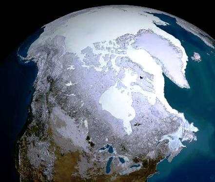
Last year, a study using data from a NASA satellite showed that Arctic sea ice thinned dramatically between the winters of 2004 and 2008.
Now – a couple years later, in its first dedicated oceanographic field campaign, more than 40 NASA scientists are heading to the Arctic to further study the impact of climate change. Their five-week expedition, dubbed ICESCAPE (Impacts of Climate on Ecosystems and Chemistry of the Arctic Pacific Environment), kicks off next Tuesday (June 15) aboard a U.S. Coast Guard icebreaker, and will focus on how varying physical, chemical, and biological ice conditions affect the ecosystems in the Chukchi and Beaufort Seas. These Seas and the Arctic Ocean, unlike others, is almost completely landlocked, making it an ideal location to study ongoing climate changes in a marine ecosystem already heavily impacted by declining sea ice cover, ocean acidification, and an increase in incoming solar radiation.
NASA’s findings will ultimately help supplement the above-mentioned data that its satellites have for years collected on arctic ice (and ice-free) conditions.
A follow-up voyage is scheduled for the fall of 2011.
Nine years ago this past week, a mere, yet intense tropical storm battered the central coast of Texas after spending two weeks dancing across the Atlantic, into the Caribbean and Gulf of Mexico. The first of the 2001 season, the Tropical Storm was named Allison and it proved that storms need not be particularly strong or fast-moving to be deadly and destructive.
With hurricane season upon us this blog post looks back on Allison in an effort to keep you 'weather-ready' and 'tropical storm- and hurricane-prepared.'
Tropical Storm Allison made landfall near Houston, Texas late on June 5, 2001. After landfall the storm stalled and produced widespread flash flooding, which resulted in what became Houston's worst natural disaster in recorded history. Flash flooding continued for days, with rainfall amounts across the state peaking over 40 inches!
This long-lived storm didn't stop there! From Louisiana to southeastern Pennsylvania, Tropical Storm Allison was a major flood disaster all the way up to the Mid-Atlantic. It was not until June 18 that the remnants of the tropical storm were finally absorbed by a frontal boundary in the northern Atlantic, which ultimately led to the the cyclone's dissipation.
Throughout its entire path, Allison caused nearly $7 billion (2010 standards) in damage and 41 deaths.
Not too many tropical storm's identities, such as Allison's, go into the 'retired storm names hall-of-fame', yet "she" managed to do so! A storm for the record books, to say the least!
A report released a couple years ago by the National Academy of Sciences warned that a solar activity storm could could cause twenty times more economic damage than Hurricane Katrina.
A statement recently released by a representative at NASA states that the sun is waking up from a deep slumber, and in the next few years we can expect to see much higher levels of solar activity. That combined with our expanding sensitivity to solar storms as a result of our society becoming more technologically dependent, could create significant societal and economic impacts in coming years.
Solar storms occur when an eruption or explosion on the sun's surface sends radiation or electrically charged particles toward the Earth. Minor storms can interfere with radio signals. A large one can release as much energy as a billion hydrogen bombs. In fact, a large solar storm in May 1859 wreaked international havoc as telegraph wires spontaneously shorted out, causing numerous fires. The event even offered up an unexpected display of the Northern Lights as far south as Rome, Havana and Hawaii! Experts say the modern day equivalent of such a storm could leave millions of people without electricity, running water or phone service.
Well, there is hope...
The Space Weather Enterprise Forum kicks off today in Washington, DC and on the forefront of its agenda is the next peak of solar activity expected in 2013, and how planet Earth will respond.
The Forum, which is part of the National Space Weather Program (NSWP), falls beneath the overall national interagency initiative to prepare the country, and ultimately the world, to deal with technological vulnerabilities associated with the space environment. Some of the agencies involved include NOAA, NASA, USGS and FAA.
To help keep us safe and to avoid that which is stated above, the Forum will focus on critical infrastructure protection to improve the nation’s ability to prepare, avoid, mitigate, respond to and recover from potentially devastating impacts of space weather events on our health, economy, and national security.
This past weekend featured two solid days of severe weather in the northeast accompanied by torrential rains and scattered violent storms containing damaging winds, hail and even funnel clouds. That's right... funnel clouds! Tornado watches were posted for a good part of the day Saturday for New England, and those watches extended southwards into the mid-Atlantic on Sunday. But while tornado activity was heightened in the cornfields of the rural midwest this past weekend, not too much actually materialized for the hilly terrain of the northeast or along the city-sprawling I-95 corridor.
OK, why the descriptive detail? Well, I've been reading several blogs about the subject this weekend and even this morning, and I want to set something straight about the myth (yes, it's a myth) that tornadoes don't occur, or are hard to form, in both mountainous terrain and cities alike.
While topography does influence how often tornadoes form, other stronger atmospheric processes determine where and when tornadoes form, meaning even those is rugged mountainous terrain are at risk. Storm systems that generate tornadoes over the midwest often rely on large amounts of moisture from the Gulf of Mexico and high quantities of atmospheric energy which aren’t always available once systems cross the Appalachians. However, if those systems remain intact, these areas, such as the Northeastern United States, are equally susceptible.
Tornadoes in cities? I can easily recall several U.S. cities being hit by a tornado in the last decade or so... Oklahoma City, Fort Worth, St. Louis, Miami... even Salt Lake (both urban and mountainous)! But in the northeast? Not so much. While it is possible, the atmospheric dynamics explained above typically do not support the development of tornadoes reaching cities like New York, Boston and Philadelphia, per se. However, the fact is tornadoes have a long history of hitting big cities and when they do, they usually cause a great amount of damage because a lot more debris is generated.
In conclusion, the severe weather threat is long gone now and the weather is gorgeous! Sadly, residents in Ohio and Michigan were not so lucky as tornadoes there as strong as EF-3, have caused extensive damage and loss of life.
Mild days and cool nights are the rule this week in the northeast... enjoy it!
There's been a whole bunch of talk about hurricanes recently and The Northeast Quadrant is no exception. But what ever happened to the good ol' fashion thunderstorm?
You do know it takes just one run-of-the-mill thunderstorm to multiply into hundreds which then transforms into thousands of organized clusters of storms that could develop into one intense low pressure center, which if in a favorable atmospheric and oceanic environment could become a tropical storm or hurricane, right?
Today's NEQ Friday Review delves deeper into the thunderstorm and explains a little more about them for those less versed in the science.
Thunderstorms generally form when moisture, an unstable airmass, and a lifting force all come together. Thunderstorms go through three stages, the developing stage, the mature stage, and the dissipation stage, and depending on the conditions present in the atmosphere, these three stages take an average of 30 minutes to go through.
There are four types of thunderstorms:
1) Single-cell thunderstorms are generally poorly organized and form when there is not much wind shear. These storms typically last less than one hour.
2) Multicell cluster thunderstorms occur when a group of cells move as a single unit, with each cell in a different stage of the thunderstorm life cycle. Multicell thunderstorms can produce moderate size hail, flash floods and weak tornadoes.
3) Multicell line thunderstorms consist of a line of storms with a continuous, well developed gust front at the leading edge. Also known as squall lines, these storms can produce small to moderate size hail, occasional flash floods and weak tornadoes.
4) Supercell thunderstorms (my favorite) is a thunderstorm with a deep rotating updraft (mesocyclone) that generally produces severe weather, including heavy winds, large hail, heavy rainfall, and sometimes strong and long-lived tornadoes. There are three types of supercells: classic supercells, HP (high precipitation) supercells, and LP (low precipitation supercells). A single supercell can last several hours.
Some of the most powerful thunderstorms on Earth occur right here in the United States as a result of frequently clashing air masses. Florida's Gulf Coast experiences the greatest number of thunderstorms of any U.S. location. On average, thunderstorms occur in the "Sunshine State" 130 days per year....
When Hurricane Katrina hit Louisiana and Mississippi the morning of August 29, 2005, the storm caused absolutely devastating large-scale destruction. The levees failed and their collapse flooded 80 percent of the city of New Orleans. By the time the waters receded and the survivors regrouped, Katrina, and then Hurricane Rita, had claimed more than 1,400 lives and the dreams of hundreds of thousands.
Now five years later a new, $7.5 million, 6,700 square-foot exhibit titled Living With Hurricanes: Katrina and Beyond, will tell the stories of real people caught in the hurricane’s wrath. It tells of their rescue, recovery, rebuilding and renewal in a way that is certain to move both those who survived the storms and those who watched them unfold on television.
The exhibit will have a series of galleries featuring sound, video and computer graphics, and it opens this fall (October 26) at the Louisiana State Museum in New Orleans.
Check out this promotional, yet very moving clip of coastal Louisiana's history and the events that led to the idea as well a what to expect when you visit the exhibit.
For me this is an absolute must-see! I hope you'll also make it a point to visit the exhibit should your travels take you there.
Sunspots may predict hurricanes as well as global warming and cooling, says a recent study conducted by Florida State University.
The study, which was presented to the American Meteorological Society and published in the scientific journal, Geophysical Research Letters, indicates the probability of hurricanes hitting the United States increases dramatically during low points of the 11-year sunspot cycle, such as we are currently experiencing.
Sunspots have long been implicated in the global climate. During periods of high sunspot activity, which occurred throughout the Medieval Warm Period, global temperatures rose. During the low points in sunspot activity, such as in the Little Ice Age, temperatures declined.
How does this affect hurricanes? Well, years with few sunspots and above-normal ocean temperatures, as is the case now, spawn a less stable atmosphere and, consequently, more hurricanes. When that happens, the differential creates more atmospheric instability and stronger storms, energizing what might otherwise remain tropical storms into hurricanes. Years with more sunspots but still above-normal ocean temperatures yield a more stable atmosphere and thus fewer hurricanes.
So here's the breakdown in numbers...
The chance of at least one hurricane hitting the United States spikes to 64 percent in the lowest sunspot years, compared to only a 25 percent chance in peak sunspot years.
Chances of three or more hurricanes hitting the United States increase from 20 percent to 40 percent in years when sunspots are in the lowest 25 percent, compared with years when they're in the highest 25 percent.
Interestingly, there are a whole bunch of predictors hurricane experts have been looking at when issuing their extreme forecasts for the 2010 Atlantic hurricane season, however, sunspots was not one of them. To that extent, the National Hurricane Center (NHC) is considering using sunspots cycles as a predictor in future forecasts as they continue to see more evidence.
Today is the first day of the 2010 Atlantic hurricane season and while currently there are no imminent significant tropical threats, on the minds of many is... 'what if' a hurricane does slams into earthquake-ravaged Haiti, and 'what if' one does in fact swirl through the Gulf oil slick?
While the likelihood of one or both of these scenarios playing out over the next 183 (or more) days is quite likely given their location and climatological history being affected by tropical systems, just a mere glancing blow could be devastating. But which is the bigger concern? Here are some of the facts...
Haiti Now more than ever, an intense tropical system affecting Haiti could prove catastrophic, and such a situation could potentially complicate difficult humanitarian relief operations following the devastating 7.0 magnitude earthquake on January 12. As it stands now, vast swathes of Haiti are devoid of greenery, soil-holding roots, trees or grasses. Centuries of deforestation as a result of mother nature's beating has left the entire country a mudslide waiting to happen. Excessive rainfall could bring to the country an increasing threat of disease and mudslides, among other hazards to the 1.7 million Haitians currently living in tent cities after losing their homes in the quake. The National Hurricane Center (NHC) has already set up better communications with Haiti to alert them to possible threats, but they know it won't be enough because there is really nowhere for them to go if a storm should threaten.
Oil Slick Although nearly 7 million gallons of oil have already spilled into the Gulf of Mexico, the oil isn't covering enough of the warm waters that feed tropical storms to alter their development, and therefore it is not likely to have a significant impact on hurricane intensity. If a hurricane swirls through the slick it may help break up the oil, but if one were to make landfall just west of the spill it could drive the oil inland on surging seawater. On the same note, a hurricane passing to the east of the slick could drive the oil away from the coast. Additionally, the high winds and seas could mix and weather the oil, which could help accelerate the bio-degradation process. A hurricane could also disperse oil further than its current location. Because there's no record of a hurricane ever crossing paths with a large oil spill, nobody knows for sure exactly what environmental impact it would have in this situation, but one could imagine it would just add to the ecological misery already occurring.
An online video talk show offering a blood pumping new look at weather from a personal perspective!
The Northeast Quadrant Radar
About The Northeast Quadrant
The Northeast Quadrant is a highly informative blog and global interactive social community for the weather obsessed, written and managed by the weather obsessed!
Near daily blog posts and news shares about ever-changing weather patterns, the evolution of dynamic storm systems, the controversy surrounding climate change; and its effects on our cities, nation and the world, The Northeast Quadrant takes you beyond the weather and brings you closer to science through its unique presentation of incredible news stories and vibrant personal experiences! With thousands of web hits directly on the blog, hundreds of Facebook fans, and Twitter followers, and an overwhelming viewer audience on YouTube, The Northeast Quadrant continues to grow!
Bookmark and subscribe to http://northeastquadrant.blogspot.com/ and enjoy! In doing so you'll join the global community from countries around the world that regularly visit The Northeast Quadrant.
What are people saying about The Northeast Quadrant?
"Congratulations to The Northeast Quadrant for making weather fun! This is not the kind of information you get from your local weatherperson." – Janette from Washington, DC
"I am in the midst of grueling Navy Weather Forecasting school. It's fun sometimes, but we don't really get into anything outside of the subject matter. I appreciate The Northeast Quadrant because it's an interesting look at weather and facts. It provides a much needed break from mundane, tedious weather lessons! Thanks Devin!" – Mack from Biloxi, Mississippi
"I really enjoy reading The Northeast Quadrant! Devin does a great job and keeps things interesting. You can see the passion he has for the tropics and that's something I always respect! I have learned as a teacher of meteorology, that you can't teach passion – you either have it, or you don't!" – Greg from Starkville, Mississippi
"Throughout all the recent Icelandic volcanic news, we at Know Your Money like to keep updated with blogs to discover their opinion of what is going on. The Northeast Quadrant offers a great deal of interest to us with regards to its intake on weather etc., and its impact on the economy... so thank you!" – Claire from United Kingdom
"I visit The Northeast Quadrant at least once a week for weather and science updates on things happening around the world. What I often find interesting is that I will read The Northeast Quadrant in the early part of the day and learn something that isn't on the news until later that night. I would be remiss if I didn't mention the fantastic pictures everyone sends in from all over!" – Staci from Union, New Jersey
"I visit The Northeast Quadrant at least 3-5 times a week. I love the pictures and funny stories, articles, quotes, etc. The blog is a good resource, it's entertaining and has valuable information. It has actually made me more interested in what is going on with the weather and why things happen." – Glen from Orem, Utah
"I find myself visiting The Northeast Quadrant more than I ever expected! I enjoy seeing Devin act so funny when he reports on various weather phenomenon. He really makes me like weather, and I particularly enjoy the photos and videos. The Northeast Quadrant has actually changed my perspective on weather and science." – Meghan from Silver Spring, Maryland
"I love The Northeast Quadrant! The information given to me is always accurate and informative. When we were listening to the news about upcoming storms this past winter, I relied on The Northeast Quadrant more than the local news. I liked watching Devin at the East River reporting and nearly getting blown away! There were always updates every few hours, and in fact I was able to prepare in advance of the storm. I also enjoy looking at and submitting personal photos pertaining to the weather!" – Robin from Edison, New Jersey
Marketing and Communications Professional; Weather Enthusiast; Recreational Storm Tracker and Reporter; and Amateur Photographer
Ever since I was a young boy I loved the weather!
There was very little that excited me more than watching The Weather Channel since its inception in 1982. Bringing weather to life was the Channel's goal, and it delivered! I remember watching the local forecast as intense lines of storms progressed towards Edison, New Jersey (where I grew up), and being called by my father to join him on the front porch as he watched the storms close in on our neighborhood. I'd run back and forth between the gusty front porch that lied beneath the darkening sky to the cool air-conditioned living room, starring at the television as I glared at the storms getting closer and closer. As the line of vibrant red's and orange's intensified, so did my interest! My obsession for weather was born, and that's where it started!
With the tools I needed at my disposal I continued to closely follow various weather phenomenon: deadly mid-western tornado outbreaks, extreme Mississippi River flooding, Hurricanes Hugo and Andrew, crippling northeastern blizzards like the '93 Superstorm, earthquakes in the Golden State, volcanoes along the Pacific Rim... you name it!
Nearly 30 years later, those who know me well would say I have not changed all that much.

 All eyes this week will be on the central Atlantic and Caribbean Sea as disturbance 92L tries to spin its way up to the first tropical cyclone of the 2010 Atlantic hurricane season. Computer models vary on the future intensity of this system, but there are favorable indications that it will become a tropical storm, and perhaps in a few days time, a hurricane. If it does so its name would be Alex.