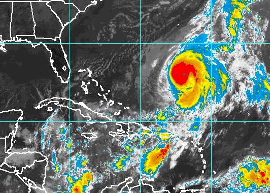
The 2011 Hurricane Season is quickly approaching, and forecasters are predicting a weakening La Niña turning into a more neutral stage by the Summer. Many people are saying how great this is, and that this basically means a very tame season awaits us in the Atlantic this year. Surely this is great news for the Gulf Coast residents and all of the Southeastern U.S. residents who could be affected by the potential storms this Summer. But I say take it with a grain of salt. This is not the time to start celebrating because La Niña may or may not be weakening by the Summer. This is the time to start preparing for the upcoming Hurricane Season regardless of anyone's early forecast of less activity.
The quote that you will hear a lot as we approach this upcoming season is "La Niña, which causes more hurricanes, will be turning to a more neutral phase for this Summer. This means less hurricanes." I don't agree with people who say this, because it gives the average person a false sense of security for the upcoming season. There are a few things to consider as we approach this June. Firstly, take a look at the image below. It is a chart of storm activity measured from 1995-2005. The bars represent the number of major hurricanes formed during each phase. During a La Niña phase there was an average of about 4 major storms formed during those seasons. Now here comes the shocker, there were actually more storms formed during a Neutral phase (which we are heading into this Summer), then were formed during the dreaded La Niña years. About 4.5 on average. There was a slight drop off for a Weak to Moderate El Niño phase. The biggest and most noticeable drop came during a Strong El Niño phase, which we are certainly not going to experience for this upcoming season.
The second thing we we need to understand is each season has a mind of its own. Each storm has a respective life journey. No one could have predicted the ridiculous activity during the 2005 season, or the incredible luck that the U.S. experienced during last season. There were tropical systems all over the Atlantic in 2010, 21 to be exact. 12 of those were hurricanes, and yet the U.S. was not affected by any of them. So 2010 was predicted to be one of the worst seasons in history. That prediction came true to an extent because of the number of storms, but as far as people affected by the systems it was over hyped. Let's go back to 1992 for a second. There were only 7 storms which formed that year, and only one land falling hurricane. That hurricane was Andrew. So although the numbers were down that year, it was one of the most devastating years in history as far as South Florida is concerned. Now back to 2005 one last time, it was quite a year as far as storms go. 28 storms made their journey across the Atlantic that year, a staggering record that probably won't be touched anytime soon. But 2005 was not a La Niña year. So although it is fun to read the preseason predictions when it comes to each Hurricane Season. Always remember that it is not an exact science. Every season has a different story. Every storm has a unique lifespan. And these story lines cannot be written before June arrives. We must all just take our seat, and watch how each season plays out.
The 2010 Hurricane Season tied with 1887 and 1995 having the third highest storm count on record with 19 named storms. But short-term weather patterns dictate where storms actually travel and in many cases this season, that was away from the United States. The jet stream’s position contributed to warm and dry conditions in the eastern U.S. and acted as a barrier that kept many storms over open water. Also, because many storms formed in the extreme eastern Atlantic, they re-curved back out to sea without threatening land. This movie shows GOES-13 infrared imagery from June 1 through November 30, the official extents of the Atlantic Hurricane Season.
Impact aside, for some time now the 2010 Atlantic hurricane season has been compared to, or at least scaled against, the record-breaking season of 2005 when numerous intense hurricanes made landfall in the United States, central America and Mexico.
With a record 12 hurricanes forming this year, the 2010 season was the most active since 2005. However, the major difference is the location in which tropical cyclones formed and the areas in which their greatest rainfall totals were deposited.
During the 2005 season, the highest tropical cyclone rainfall totals (between 28 and 32 inches) were deposited over the Caribbean Sea, eastern Gulf of Mexico, western Cuba and over the waters in the Atlantic off the southeastern U.S. coast. During the 2010 season the highest tropical cyclone rainfall totals (also between 28 and 32 inches) were deposited over the open waters of the Atlantic north of Puerto Rico.
The image above shows the tropical cyclone rainfall occurring in 2010. This year, south Texas was the only location in the U.S. where tropical cyclone rainfall was greater than in 2005.
With the official close of the 2010 Atlantic hurricane season still a week away, the season in pretty much all respect, is over. Sure a late-season storm or two could pop up, but the general pattern observed over the past couple weeks looks to continue, therefore furthering unfavorable conditions for development.
So... how did the season add up? The usual skeptics will say it was a bust, but in my opinion 2010 was remarkably awesome for several reasons – we reached the predicted numbers making the 2010 season one of the most active in history, and while the U.S. experienced little impact, NOAA hit the nail on the head with its early season prediction, calling for:
14 to 23 named storms
8 to 14 hurricanes
3 to 7 major hurricanes
Now check out the actuals:
Average (1966–2009)
2010
Named Storms
8
19
Hurricanes
4
12
Major Hurricanes
1
5
Pretty darn amazing eh? Here's a look at the hurricanes of 2010...
Here we are in late October and the northwest Caribbean remains a breeding ground as we now have Tropical Storm Richard. Richard, which should become a hurricane over the next day or so, is spinning its way slowly westward towards the Yucatan Peninsula. That's right, yet another Yucatan threat! But what about the United States? Well folks, this might be the one to watch! Find out in this episode of The Weathervein where Richard is heading, how strong he could get, who might be impacted in the short- and long-range and what it could mean for the Gulf coast! We're hurricane ready on The Weathervein... are you?
On Sunday night Super Typhoon Megi and it's 180+ mph winds barreled into northern Luzon in the Philippines as the strongest tropical cyclone of the 2010 season. With a minimum pressure of 885 millibars at landfall, Megi, known locally as 'Juan,' could perhaps go down as the strongest landfalling tropical cyclone ever!
Last night via Skype I caught up with Claiv Marco from Manila and he provided insight into the state of calamity in northern Luzon, the effects Megi had on his region south of the disaster zone, and an update where Megi is now and where it is headed, as well as some historical perspective on typhoons striking the Philippines.
Claiv is a big fan of The Northeast Quadrant and I thank him greatly for this interview. Check it out here... Claiv Marco: good evening devin
Devin Matthew Toporek: hi!
Claiv Marco: oh, sorry for waiting
Devin Matthew Toporek: no problem
Devin Matthew Toporek: you have video?
Claiv Marco: my web cam unavailable
Devin Matthew Toporek: oh that is too bad. was hoping to record something so i could repost it and share with those on the northeast quadrant page.
Devin Matthew Toporek: so how are things there?
Claiv Marco: its too bad
Claiv Marco: mostly in the Northern part
Devin Matthew Toporek: what are you hearing?
Claiv Marco: power poles and lines were destroyed
Devin Matthew Toporek: i'm sure!
Claiv Marco: most of the towns and provinces in northern Luzon has no power
Claiv Marco: even telecommunication networks
Devin Matthew Toporek: i would imagine the storm surge was incredible! do you know how high it was?
Claiv Marco: what i've heard is about 18-20 feet
Claiv Marco: along the east coast
Devin Matthew Toporek: wow!
Devin Matthew Toporek: i would have expected even more!
Devin Matthew Toporek: during Hurricane Katrina there was almost a 30 feet surge
Devin Matthew Toporek: and 20+ with Ike
Claiv Marco: maybe its because the area there is too terrain
Devin Matthew Toporek: probably because there is also less influence from a continental shelf like we have here in the United States
Devin Matthew Toporek: is the area where Megi made landfall heavily populated?
Claiv Marco: in some part mostly in the Ilagan City Isabela, where its eye passed, the entire province of Isabela is now under state of calamity, and hundreds of houses destroyed
Devin Matthew Toporek: unbelievable! i can only imagine!
Devin Matthew Toporek: i find it interesting but extremely fortunate that i have only heard of a few deaths from this storm, so far. it just amazes me because in a storm like that we would lose hundreds, if not thousands... it's happened before here and i am sure it would again. you are very lucky.
Claiv Marco: yes and we are very thankful to God
Devin Matthew Toporek: so tell me... what was the feeling like there when Megi was approaching. what were the weather forecasters and government telling the residents of northern Luzon province?
Claiv Marco: all of the evacuees stayed in gymnasiums and schools
Claiv Marco: before the landfall
Devin Matthew Toporek: good!
Claiv Marco: but unfortunately
Claiv Marco: the rice fields, corn fields and other sources of their livelihood were totally destroyed
Claiv Marco: they are crying
Devin Matthew Toporek: that is sad, i cannot imagine what it would be like to realize such a loss! as i said, they're very lucky to have their life though.
Devin Matthew Toporek: did you see or hear of many northern residents evacuating to your area down south?
Claiv Marco: i didn't heard something, i think they all just stayed in government properties in their provinces maybe because they'll be having hard time to go south because you need to cross mountains before going south and they don't need to leave their places
Devin Matthew Toporek: oh, i see.
Devin Matthew Toporek: so tell me, living in the Philippines... you have seen quite a few Typhoons, right? which ones do you recall the most and why?
Claiv Marco: oh great question
Claiv Marco: i'm gonna share you a lot
Devin Matthew Toporek: can't wait!
Devin Matthew Toporek: go for it!
Claiv Marco: Ok, the most intense and powerful typhoon that I experience in Manila is Typhoon Xangsane or Milenyo here in the Philippines. Because of Xangsane, I became interested in typhoon forecasting.
Devin Matthew Toporek: how old were you when Xangsane hit, and how strong was it?
Claiv Marco: i think i'm 17
Claiv Marco: it's too strong for us living in the city
Devin Matthew Toporek: what was the devastation like?
Claiv Marco: lots of billboards collapse and fell down in major roads
Claiv Marco: trees fell over roofs
Devin Matthew Toporek: sounds scary! but fun at the same time, obviously that is the weather enthusiast and storm chaser in me speaking!
Devin Matthew Toporek: i bet if Megi made landfall near Manila the effects would be far worse than what they were!
Claiv Marco: yes i understand, i feel the same way too
Claiv Marco: Oh wow maybe
Claiv Marco: i think there will be lots of damages
Devin Matthew Toporek: and what about Milenyo? how strong was that storm and how old were you?
Claiv Marco: Xangsane is Milenyo
Claiv Marco: we change typhoon name when in enters the territory
Devin Matthew Toporek: oh, how interesting! is that why Megi you began calling it Juan?
Devin Matthew Toporek: why do they change the typhoon names when they enter the Philippines territories?
Claiv Marco: because our authorities wanted to have clear number of storms that enters the country and it is alphabetical in order
Devin Matthew Toporek: again, how interesting!
Claiv Marco: right now we are experiencing strong winds and heavy rain here in southern Luzon including Manila
Claiv Marco: because of the outer rainbands
Devin Matthew Toporek: right, i saw that the typhoon's outflow was still impressive!
Devin Matthew Toporek: it was amazing though last night to see just how quickly the storm deteriorated once it made landfall. that high terrain just ripped it apart...
Devin Matthew Toporek: though having it still emerge over the south china sea as a strog category 2 (hurricane) is yet again impressive.
Claiv Marco: yes and it still intensifying
Devin Matthew Toporek: right... will continue to do so until its second landfall later this week in southeast china.
Devin Matthew Toporek: should not be a strong as it was though, right?
Claiv Marco: yes, and i think its forecast is to move near hong kong
Devin Matthew Toporek: i saw that!
Devin Matthew Toporek: hong kong looks like it will be in "the northeast quadrant" no less!
Devin Matthew Toporek: my work has a conference in hong kong later this week! crazy!
Claiv Marco: I see, wow, hope to be like what you are doing
Claiv Marco: Ok i'll share more experiences in typhoons
Devin Matthew Toporek: yes, please!
Claiv Marco: as i've said the most powerful that i experienced was milenyo, now i'm gonna tell you the most devastating, it is typhoon Ondoy or Ketsana in international name
Claiv Marco: it hit Manila as a Tropical Storm
Devin Matthew Toporek: oh yeah? what was so bad, the rain?
Claiv Marco: yes too bad,the entire Metro Manila almost submerged
Claiv Marco: it brought 348.4 mm of rain
Devin Matthew Toporek: wow!
Devin Matthew Toporek: we had a bad tropical storm here about ten years ago. it's name was Allison.
Devin Matthew Toporek: similar devastation from flooding rains...
Devin Matthew Toporek: so are you going to study weather when you go to college?
Claiv Marco: wow 40 in
Devin Matthew Toporek: yeah, Allison was horrible!
Claiv Marco: i just study by myself over the web, and meteorology is not actually my course
Devin Matthew Toporek: you are great at it! i see your posts and maps on your facebook wall. keep up the good work!
Claiv Marco: thanks!! i just wanted to tell and warn my friends
Devin Matthew Toporek: let's make a deal! if the opportunity presents itself, and let's hope it does soon, you can come to the U.S. and chase a hurricane with me and i come there and chase a [super]typhoon with you!
Claiv Marco: wow, if that's it, let's see
Devin Matthew Toporek: easier said than done right??? ;-)
Claiv Marco: yes, it's not that easy
Claiv Marco: mostly in my case
Devin Matthew Toporek: well let's hope you and your family and friends and all those in the Philippines and south China as well - all stay safe for the rest of the season!
Claiv Marco: Yours likewise! God Bless you!
Devin Matthew Toporek: stay in touch... and good luck in school!
Claiv Marco: Thank you, by the way i already graduated Devin Matthew Toporek: do you mind if i post this conversation on the northeast quadrant and blog? i am sure people would be so interested to hear about it! Devin Matthew Toporek: oh, i'm sorry. i thought you were still in school... well good for you then! Claiv Marco: It's Ok, Thanks for a great conversation Devin Matthew Toporek: you too! have a good day...
Comprehensive hurricane research project proves successful!
Last week NASA concluded its GRIP (Genesis and Rapid Intensification Process) hurricane research mission aimed at gaining a better understanding of tropical cyclone behavior—how they form, evolve and strengthen, and how they weaken and die. GRIP, which launched in mid-July, promises to revolutionize tropical weather forecasts in years to come.
How it worked The GRIP mission analyzed storms with manned and unmanned aircraft as well as satellite imagery. The aircraft, ready for deployment at a moments notice, were based along the U.S. Gulf coast and northern Caribbean islands and were equipped with 15 weather instruments, ranging from an advanced microwave sounder to dropsondes—gadgets that record atmospheric and surface measurements as they fall through the atmosphere to the ocean surface.
The perfect specimens While tropical cyclone impact for the season remains quite low for U.S. coastal communities, two hurricanes, Earl and Karl were significant for GRIP's research. Earl, a category 4 storm that spun through the central and western Atlantic, was analyzed as it rapidly intensified and degraded off the southeast coast before heading northward towards the Canadian maritime region. During this time GRIP sent several aircraft into the storm, penetrating its eye and sending back critical storm data that offered insight into wind speed and direction as well as wind shear's affect on hurricanes moving swiftly through northern latitudes. Similarly, Karl, which was a strengthening category 3 at landfall, was penetrated by additional aircraft as it plowed into the Mexican coast. These aircraft captured valuable data such as cloud temperature, air pressure, humidity, precipitation, convection and sea surface temperatures. GRIP continued it's research after Karl moved inland and deteriorated, also providing perspective on how land friction affects hurricane degradation.
The seasonal scorecard The 2010 Atlantic hurricane season concludes November 31 and remains quite active, with 18 storms, of which 16 have been named. 8 of those named storms became hurricanes, of which 5 were major.
The Weathervein is back and we're recapping the tropics and providing the latest information on soon-to-be Hurricane Paula in the northwest Caribbean, as well as a developing nor'easter for the northeast U.S. later this week! Check it out here in Episode 16 of The Weathervein!
You might be wondering what the numbers in the title of this post refer to. Well wonder no more because I'm going to tell you these numbers reference the scorecard for the 2010 Atlantic hurricane season – a season that will go down in the record books as one of the most active in history!
Wait, what!? How can it be one of the most active?
You mean you haven't heard that more than half the storms, major hurricanes included, have gone out to sea as 'fish storms?' That's right... it's been a very active hurricane season but with little U.S. impact, who knew?!
With the formation of Hurricane Otto today, the 2010 Atlantic hurricane season now features a total of 17 storms, 15 of which have been named and of those, 8 became hurricanes. Of those hurricanes, 5 were majors (category 3, i.e. 115 mph or higher). A typical hurricane season produces about 10 storms, of which 6 become hurricanes.
Before the start of hurricane season experts warned of the threat of not only an active season but a very high impact one, however, as mentioned and observed, U.S. impact has been quite minimal outside of a few tropical storms, a depression and glancing blow from Hurricane Earl.
While we are hitting the numbers big time, somewhat unexpected atmospheric conditions have steered a great number of storms away from U.S. coastlines. Who's complaining right? Well, aside from the storm chasers and weather enthusiasts!
Hurricane tracks are greatly influenced by the aforementioned atmospheric conditions. The upper level currents steer hurricanes in a variety of ways and storm tracks are highly dependent on where the storms form and the steering currents at that particular time. According to National Hurricane Center (NHC) Director, Bill Read, with the weather pattern that was in place and the fact that this season's storms formed so far out to the east, it's not surprising that they turned off to the north. As soon as you find a weakness in the big high (known as the Bermuda High) you'll get that effect. This follows the same methodology that Greg Nordstrom and I refer to often in The Weathervein. When storms form east of 35W longitude they will 9 out of 10 times curve out to sea.
Time will tell what the remainder of hurricane season will bring but we only have 6 names left on the list before they are used up. Those names are Paula, Richard, Shary, Tomas, Virginie and Walter. Thereafter we would be required to begin using the Greek alphabet as we did only one time before – in 2005. However, time is running out.
As mentioned the other day we are well into an above-average Atlantic hurricane season, now recording 14 named storms from Alex to Nicole, and two unnamed tropical depressions. That leaves us with just seven more names available until we would need to cut into the Greek alphabet – which has only been done once in history – in 2005. Given statistical guidance, it could happen again.
According to the National Hurricane Center (NHC), 27.3 percent of all tropical storms and 26.7 percent of all hurricanes since 1851 have formed between today, October 1 and December 31, (despite the seasons official close on November 30), and in fact, October rivals August when it comes to the number of tropical storms that form in waters that are still warm, such as the Gulf of Mexico and Caribbean Sea.
In 2005, a season that featured similar favorable tropical development conditions as the 2010 season, nine storms were recorded in October alone, and an additional four storm developed through the turn of the new year (2005– 2006). Even though there are no indications a situation like that would evolve during the next few months, it would not take much – just a gradual storm here and there – to easily advance us through the remainder of the alphabet. But that said, what happened to impact? This season was dubbed the season of impact, not the season of numbers?
It only takes one, so what imminently lies ahead? The NHC is now tracking a new invest area called 97L which has a 40 percent chance of development over the next couple days. Should it develop it would become Tropical Depression #16 and/or Tropical Storm and/or Hurricane Otto. This is a system that in the near-term the Leeward islands of the Caribbean will want to watch.
Regarding the Gulf of Mexico, this area is blocked for development, at least for now. The Caribbean continues to produce a lot of disorganized convection left behind from Matthew and Nicole, but nothing appears to be boiling into a tropical cyclone (yet).
Now in related news I'd like to provide you a link to NOAA's Historical Hurricane Tracking Tool which allows users to search by U.S. zip code, state or county, storm name or year, or latitude and longitude points to plot some of the greatest storm tracks from year's past. The site includes tropical cyclone data and information on coastal county hurricane strikes through 2009. It also features a searchable database of population changes versus hurricane strikes for U.S. coastal counties from 1900 to 2000 and includes detailed reports on the life history and effects of U.S. tropical cyclones since 1958. Check it out here.
I created a graphic this morning for The Northeast Quadrant's Facebook page WEATHER PHOTO OF THE DAY album which depicts satellite images of the four category 4's of 2010 (so far), featuring Hurricanes Danielle, Earl, Igor and Julia.
These four storms were classic Cape Verde hurricanes and while Danielle and Julia remained out to sea, Earl and Igor directly and indirectly impacted land mass. Both Igor and Julia attained category 4 strength simultaneously – an occurrence that has not happened since September 16, 1926.
I thought this was a pretty cool way of showing that no two storms are alike despite their similar characteristics!
After a slow start to a hurricane season that was hyped to be anything but slow, today marks the first full day since the development of Tropical Depression #6 on August 21 (which would later become Hurricane Danielle) that we've gone without a named storm in the Atlantic basin. Although we almost did it between September 5–6 when Hurricane Earl dissipated in the north Atlantic, we were surprised when Tropical Depression #10 (which would later become Tropical Storm Hermine) quickly spun up in the southwestern Gulf of Mexico before making landfall in extreme northeastern Mexico. This marks a total of 36 days having a named storm, the longest such period since the 2002 Atlantic hurricane season, which had remained completely active for 45 days from August 29 through October 12.
We are well into an above-average Atlantic hurricane season with 13 named storms and two unnamed tropical depressions, and there are only eight more names available for use before we'd need to break into Greek alphabet, which has only been done once in history – during the epic 2005 Atlantic hurricane season. With that said, today's break in activity leaves us on edge after yesterday's degeneration of both Lisa and Matthew, wondering where Nicole is... and will Otto follow?
According to the National Hurricane Center (NHC) there is an increasingly likely chance we'll see our next named storm this week as an area of convection continues to flare up in the northwest Caribbean Sea which in the short-term seems to have its eyes on the southeastern Gulf coast. Meanwhile, a very small area of convection flared overnight in the central Atlantic, but development of this system is not likely in the near-term.
There is not yet an official invest on the system in the Caribbean but by day's end I would expect to see 96L pop up! At that time the computer models should have a better handle on what the system might do – where it might go, how fast it might develop and how strong it could become. To that extent I encourage all interests in the northwest Caribbean and Gulf of Mexico to monitor possible development in this region as the break in tropical activity seems to be short-lived!
[UPDATE #1: As of 3:30 p.m. ET 09-27-10, we officially have 96L invest.] [UPDATE#2: As of 11:00 a.m. ET 09-28-10, we officially have Tropical Depression #16.] I'll leave you with 2010 Atlantic hurricane season scorecard, courtesy of The Weather Channel:
Greg and Devin provide an in-depth recap of their experience riding out and chasing Hurricane Igor in Bermuda!
Earlier this evening Greg Nordstrom and I were featured on The Barometer Bob Show as we recapped our Hurricane Igor chase in Bermuda! Scroll to minute 20:10 to hear the interview...
September 2–3, 2010 – Chatham, Massachusetts, Cape Cod
Well, I am back from chasing Hurricane Earl in Chatham, Massachusetts on the far southeast tip of Cape Cod. Despite Earl's weakened state, having made its closest approach as a strong tropical storm, the experience was unforgettable!
I began tracking Earl the moment it emerged from the west coast of Africa into the Atlantic Ocean as a well-defined tropical wave which became Tropical Depression #7 on August 25, and later that day became Tropical Storm Earl. Fighting shear and the outflow from major Hurricane Danielle, Earl was slow to get its act together, but as it approached the northern Leeward Islands on August 29, it was game on!
Earl became a monster category 4 hurricane on August 30 and fluctuated in intensity while remaining a major hurricane as it moved northwestward towards the mid-Atlantic coast of the United States. Earl weakened to a category 2 hurricane as it neared the North Carolina coast and further weakened to a strong tropical storm as it neared Cape Cod and surrounding islands.
Earl's forecast sure was tricky, but ya know... I have give it up for the computer models! They handled this storm extremely well, maintaining convergence for days on a "just offshore" scenario. Many folks speculated that Earl could or would make landfall on the North Carolina coast or Cape Cod (or even Long Island), but the evidence available showed otherwise. I am not a professional forecaster, but I do have common sense to believe scientific evidence, and it is that evidence that eventually made this forecast pan out as expected.
I want to 'shout out' to my good friend Greg Nordstrom who called the scenario that panned out well in advance of it doing so. Greg maintained the offshore path in his forecasts for a good week prior to it taking place and he even nailed the mileage the center of circulation would track in it's closest approach to the U.S. coastline. I also need to shout out to Greg in thanking him for staying in touch with me while on my chase, providing constant updates on Earl's current location and intensity at the time. His input helped put me in the closest position on the Cape to witness the 'worst' (or 'best') of the storm in a mindful, safe manner.
That said, here's a video and some photosthat I captured during the chase...
I hope you all enjoyed this recap and footage. Before I conclude I'd like to highlight a couple of my 'personal highs' of the chase...
While on the beach in Chatham I stumbled upon (okay, I admit there was a bit of stalking involved) The Weather's Channel's Paul Goodloe who was kind enough to speak with me for a bit and even took took the time to suggest some great places to ride out the storm. His advice was great and as you saw above – we captured some great shots!
I was also granted a surprise interview with CBS News' Randall Pinkston who was was being followed by a cameraman filming their own coverage of the storm. Randall nicely asked what I was doing there, riding out the storm!? I explained I was chasing Earl and within seconds I had a camera on me and a microphone pointed towards my face... and the result – this interview!
Well there you have it! I look forward to bringing you even more from a bigger, stronger storm in weeks to come!
Danielle strengthened into a category 2 hurricane last night, and just as quick as it intensified, it also rapidly weakened and is now once again, a tropical storm. What does the future hold for Danielle and is there a new storm brewing in her wake? Could we be looking at not one, but two hurricanes over the next few days? Find out in this episode of The Weathervein as Devin and Greg update you on the state of the tropics as well as pay tribute to Hurricane Andrew on its 18th anniversary!
There continues to be a lot of speculation as to whether or not the predictions for an extreme hurricane season will validate. I continue to firmly argue they will, and that until we are in November and the season is nearly over, there is no room for disagreement.
Some of the nastiest, most high-impact seasons did not get going until September, and I really think this season will do the same. In 2001 the first hurricane did not even form until the second week of September – and then there ended up being a total of nine hurricanes that season! Just goes to show you...
I continue to encourage the hurricane season pessimists out there to hold their breath and stop mocking and bashing the experts who have far more experience predicting hurricanes than the spectators who are quick to call them out.
Now on a more reminiscent note from hurricanes past, this week’s NEQ Friday Review will look back at a historic northeastern hurricane through the eyes of a fan of The Northeast Quadrant. Here, Nick Panico, a secondary education science teacher from Suffolk County, Long Island, New York, tells his story of Hurricane Gloria from September 1985.
"I remember Hurricane Gloria even though I was only eight and a half years old at the time. My family was living in Mastic Beach, which is a small peninsula surrounded by the Atlantic to the South and the Bay to the east and west, in Suffolk County, Long Island. We were told to evacuate on the morning of September 25, 1985 because our house was located about .6 of a mile just north of the Bay.
Gloria was hyped up to be the Mega-Storm or Storm of the Century because it was a category 4 hurricane just south of North Carolina. Then, what normally saves New England, actually took place. Gloria came north, clipped the Outer Banks of North Carolina and weakened, later arriving in Long Island only as a category 1.Sources argue the hurricane’s true strength upon landfall, but I know the damage I saw would verify a category 1 storm. There was no electricity for 10 days so in the eyes of many, Gloria was considered a major hurricane.
Speaking of major hurricanes, I had recalled folks saying something about 1938, even thought I had no clue as to what they were talking about since I was so young. I later learned an intense hurricane barreled through the very soil I lived on, causing extensive damage and killing hundreds. After learning more about it I began my own extensive research on the 1938 Long Island Express.
Back to Gloria – the population at the time Gloria made landfall on Long Island was no way near as great as it is now. If a hurricane of Gloria’s strength made landfall now, the effect would be absolutely devastating.Besides the risk of extreme flooding from both tropical rains and that from storm surge, the increase in development over the last 20 years would lead to significant structural damage – to homes, businesses, and personal and public property alike. Agriculture would be greatly affected – the loss of trees and damage to farmland and vineyards that line Long Island’s north shore could suffer an extreme loss. Seeing what happens to these areas during a winter nor’easter, it is difficult to imagine what would happen if even a category 1 storm rolled through.”
Now you might be wondering why I am sharing Nick’s story. Well, if you’ve been keeping up with The Northeast Quadrant you know by now that the northeast is overdue for a hurricane landfall, and perhaps this year will be the year it happens.
I mentioned last week that the Atlantic is prime and the pattern set up now very much favors tropical cyclone activity to reach coastlines from the Gulf to the northeast. Experts have said areas from North Carolina to Maine have a chance nearly equal to that of Florida and the Gulf coast in being hit with a hurricane. It’s happened before, and it will happen again.
The six costliest hurricanes in United States history have all occurred since 1992, with five of the six happening since 2004 – Hurricane Katrina in 2005 of course being the worst of all. Most of these storms took place during the month of August.
Speaking of August, we're not even one week into the first peak month of hurricane season, and to many, the season already is being considered a bust. But alas, tropical pessimists hold your breath! After reading today's NEQ Friday Review you might reconsider that thought.
I've been saying for months now it's not all about the numbers this season – it's about impact. The Atlantic is prime and the pattern set up now very much favors tropical cyclone activity to reach coastlines from the Gulf to the northeast. Let's look back at prior seasons with a similar set up...
1933 With 21 storms, the 1933 Atlantic hurricane season was the second most active on record. The season produced several deadly storms and all but one affected land at some point. 19 storms that season made landfall as tropical cyclones, and one as an extratropical storm. Of these, eight tropical storms, including six hurricanes, hit the United States alone, including the Chesapeake Potomac Hurricane, which is considered one of the most severe in history along the mid-Atlantic.
2004 The 2004 Atlantic hurricane season was one of the deadliest and most costly seasons on record. The season produced 16 tropical cyclones, including 15 tropical storms, nine hurricanes and six majors. The most noteworthy storms for the season were the five that made landfall in Florida and Alabama, three of which were majors. Those were Tropical Storm Bonnie and Hurricanes Charley, Frances, Ivan and Jeanne. What is important to note about this season is that when you compare it to the 2010 season thus far, we are already ahead!
2005 The impact of the 2005 season was widespread and severe to say the least, and conditions this year eerily mirror that of this epic season. A record 28 tropical and subtropical storms formed, of which a record 15 became hurricanes. Of these, seven strengthened into major hurricanes, while five became Category 4 hurricanes and four reached Category 5 strength. The storms of the 2005 season were extraordinarily damaging and were responsible for significant loss of life.The hardest-hit area was the United States Gulf Coast from eastern Texas to the Florida Panhandle. Of the storms that made landfall, five of the season's seven major hurricanes – Dennis, Emily, Katrina, Rita, and Wilma – were responsible for most of the destruction.
Now you might be wondering why I did not include 1992? After all, that was the year category 5 Hurricane Andrew barreled through south Florida and later made a second landfall along the Louisiana coast. Well, 1992 was a pretty quiet year. Sure it only takes one bad hurricane to have huge impacts, such as Andrew did... but the season itself was generally pretty quiet and non-comparable to the set up we have now.
So that's that - remember, it's not about the numbers so put your calculators away. The tropics are about to kick up in full force over the next several weeks so now is the time to brace for impact!
It's been a relatively quiet Atlantic hurricane season thus far. Nearly two months in and just one named storm – Hurricane Alex, and a tropical depression – #2, had caught the attention of storm chasers, meteorologists and weather enthusiasts alike.
The slow start has led to the downward revision in named storms this week by Weather Services International (WSI). WSI, a member of The Weather Channel companies, which provides professional on-air weather systems and forecasting tools for television, is now calling for 19 named storms, down from 20 in its June forecast. WSI is maintaining its outlook for 11 hurricanes and 5 majors, which is well above the 1950-2009 averages of 10 named storms, 6 hurricanes, and 2 majors. The company says although it cut its forecast, it still sees an active season with water temperatures and wind conditions conducive to violent storms.
Further, WSI's reliable computer models continue to indicate that the area from the Outer Banks of North Carolina northward to Maine is twice as likely as normal to experience a hurricane this year, and the threat to the Northeast coast this season is on a par with that in Florida and the Gulf coastal states.
My thoughts: Although we've had a pretty quiet start to the hurricane season things are going to begin heating up in a hurry! August through October is expected to be a very active period, painting a much different picture than June and July. Remember, this season is not only about the numbers and intensity, which may or may not meet expectations, but impact! See earlier blog post here.
NASA released this week a satellite imagery movie showing the life cycle of Hurricane Alex, the first named storm of the 2010 hurricane season, and the only storm to form during the month of June. The movie was put together by a compilation of GOES-13 captures over the course of two weeks, and is a definitive example of one of the tropical-storm-in-ten which bloom into a hurricane, therefore honoring Hurricane Alex as today’s NEQ Spotlight!
After struggling across hurricane alley as Invest 93L during the last two weeks of June, Tropical Depression # 1, which formed on June 25, managed to strengthen into Tropical Storm Alex on June 26 before making landfall along the coast of Belize. Being downgraded back to a tropical depression before reaching the calm of the Gulf of Mexico, Alex quickly spun back up into a tropical storm and further strengthened into a hurricane on June 29 before making a final landfall in northeast Mexico on July 1.
Hurricane Alex's heavy rainfall flooded towns, created mudslides, caused waterways to overflow and broke records. Sadly, it also proved fatal to at least 30 people.
Nearly a month and a half into what is expected to be an epic hurricane season, and all we have seen so far is one named storm, Hurricane Alex, and a poorly organized tropical depression. There is barely a thunderstorm to be had in the Atlantic basin this week and a vast layer on dry Saharan dust has limited the hope for activity in the very near term. Despite the slow start and bleak outlook for a storm right now, expectations remain for an active hurricane season.
On average in July, we typically do not see all that many storms. What I think is making this hurricane season seem to fall short of expectations is the need for comparison to 2005, where the month of July was record-breaking – in numbers of storms and storm intensity.
One thing we must note this season is not only the numbers and intensity, which may or may not meet expectations, but impact! The pattern that is set up now very much favors tropical cyclone activity to reach U.S. coastlines from the Gulf to the northeast. In fact, the probability of a storm getting into the Gulf is about 44 percent this year, and normally it's about 30 percent. Additionally, yet another month of record warm sea surface temperatures in the Atlantic Basin was recorded in June – a trend that is likely to continue as we press on towards the peak part of hurricane season, which runs from mid-August through mid-October. Combine these factors with an expected decrease in Saharan dust and low wind shears, trouble could be brewing on the horizon.
Regarding impact as the bigger threat as opposed to high numbers of storms expected this season, check out this perspective from past seasons where the numbers of storms were quite low, but impact was quite high: In 1965, there were only seven named storms, one of which was Betsy, the first billion-dollar hurricane. Another example is Hurricane Andrew in 1992. There were only seven named storms that year as well, but Andrew was the costliest in history until Katrina came along in 2005.
Again, there are no imminent threat areas to discuss in the tropical Atlantic today, and none of the reliable computer models is calling for tropical cyclone development over the next seven days. Beyond that, things could get more interesting! Remember, according to NOAA there is still a 70 percent chance of 14 to 23 named storms to develop this season, of which 8 to 14 could be hurricanes, and 3 to 7 becoming majors. With a month and a half behind us and only one named storm, that prediction could allow for a busy few months ahead where we’ll be tracking several storms at the same time!
For now, please stay tuned and be hurricane ready – I think August and September (maybe October too) will have some tricks up its sleeves!
An online video talk show offering a blood pumping new look at weather from a personal perspective!
The Northeast Quadrant Radar
About The Northeast Quadrant
The Northeast Quadrant is a highly informative blog and global interactive social community for the weather obsessed, written and managed by the weather obsessed!
Near daily blog posts and news shares about ever-changing weather patterns, the evolution of dynamic storm systems, the controversy surrounding climate change; and its effects on our cities, nation and the world, The Northeast Quadrant takes you beyond the weather and brings you closer to science through its unique presentation of incredible news stories and vibrant personal experiences! With thousands of web hits directly on the blog, hundreds of Facebook fans, and Twitter followers, and an overwhelming viewer audience on YouTube, The Northeast Quadrant continues to grow!
Bookmark and subscribe to http://northeastquadrant.blogspot.com/ and enjoy! In doing so you'll join the global community from countries around the world that regularly visit The Northeast Quadrant.
What are people saying about The Northeast Quadrant?
"Congratulations to The Northeast Quadrant for making weather fun! This is not the kind of information you get from your local weatherperson." – Janette from Washington, DC
"I am in the midst of grueling Navy Weather Forecasting school. It's fun sometimes, but we don't really get into anything outside of the subject matter. I appreciate The Northeast Quadrant because it's an interesting look at weather and facts. It provides a much needed break from mundane, tedious weather lessons! Thanks Devin!" – Mack from Biloxi, Mississippi
"I really enjoy reading The Northeast Quadrant! Devin does a great job and keeps things interesting. You can see the passion he has for the tropics and that's something I always respect! I have learned as a teacher of meteorology, that you can't teach passion – you either have it, or you don't!" – Greg from Starkville, Mississippi
"Throughout all the recent Icelandic volcanic news, we at Know Your Money like to keep updated with blogs to discover their opinion of what is going on. The Northeast Quadrant offers a great deal of interest to us with regards to its intake on weather etc., and its impact on the economy... so thank you!" – Claire from United Kingdom
"I visit The Northeast Quadrant at least once a week for weather and science updates on things happening around the world. What I often find interesting is that I will read The Northeast Quadrant in the early part of the day and learn something that isn't on the news until later that night. I would be remiss if I didn't mention the fantastic pictures everyone sends in from all over!" – Staci from Union, New Jersey
"I visit The Northeast Quadrant at least 3-5 times a week. I love the pictures and funny stories, articles, quotes, etc. The blog is a good resource, it's entertaining and has valuable information. It has actually made me more interested in what is going on with the weather and why things happen." – Glen from Orem, Utah
"I find myself visiting The Northeast Quadrant more than I ever expected! I enjoy seeing Devin act so funny when he reports on various weather phenomenon. He really makes me like weather, and I particularly enjoy the photos and videos. The Northeast Quadrant has actually changed my perspective on weather and science." – Meghan from Silver Spring, Maryland
"I love The Northeast Quadrant! The information given to me is always accurate and informative. When we were listening to the news about upcoming storms this past winter, I relied on The Northeast Quadrant more than the local news. I liked watching Devin at the East River reporting and nearly getting blown away! There were always updates every few hours, and in fact I was able to prepare in advance of the storm. I also enjoy looking at and submitting personal photos pertaining to the weather!" – Robin from Edison, New Jersey
Marketing and Communications Professional; Weather Enthusiast; Recreational Storm Tracker and Reporter; and Amateur Photographer
Ever since I was a young boy I loved the weather!
There was very little that excited me more than watching The Weather Channel since its inception in 1982. Bringing weather to life was the Channel's goal, and it delivered! I remember watching the local forecast as intense lines of storms progressed towards Edison, New Jersey (where I grew up), and being called by my father to join him on the front porch as he watched the storms close in on our neighborhood. I'd run back and forth between the gusty front porch that lied beneath the darkening sky to the cool air-conditioned living room, starring at the television as I glared at the storms getting closer and closer. As the line of vibrant red's and orange's intensified, so did my interest! My obsession for weather was born, and that's where it started!
With the tools I needed at my disposal I continued to closely follow various weather phenomenon: deadly mid-western tornado outbreaks, extreme Mississippi River flooding, Hurricanes Hugo and Andrew, crippling northeastern blizzards like the '93 Superstorm, earthquakes in the Golden State, volcanoes along the Pacific Rim... you name it!
Nearly 30 years later, those who know me well would say I have not changed all that much.